
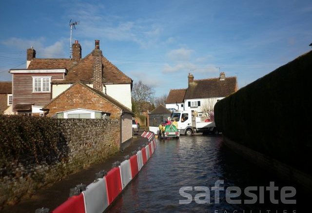
A rainy day is dispiriting for many people, but even more so when it brings the prospect of flooding to homes, businesses and public services. According to the UK’s Met office, Spring 2018 saw March and April bringing 110% of average rainfall. But then there were storms in May which saw lightning strikes and flash flooding across areas of the UK, with some areas having the equivalent of an entire month’s worth of rain in just a few hours (BBC).
Episodes of wet weather are often the cause of problems at a topographical level, such as rivers bursting their banks, and having free flow as a result of changes to the landscape, like roadbuilding or removal of hedgerows due to changing agricultural methods; and at a localised, infrastructure level with flooding caused by local drainage systems being overloaded with surface water, drainage and sewage flooding.
And of course, extreme weather isn’t the only flood risk factor for the UK: climate change resulting in rising sea levels also plays its part. Rising sea levels make the British Isles increasingly at risk of flooding from coastal erosion, as well as the risk from all those rivers which criss-cross the counties of the UK, swollen by ever-rising tides.
The situation now holds such relevance to the UK, that the Environment Agency has issued a separate climate change flood risk warning.
Running the risk
It’s no wonder then that, according to the Environment Agency, over 5 million properties – that’s one in five homes – are at risk of flooding.
Knowing whether you’re at risk can be a starting point for taking action, so where are those areas most at risk – and how can you find out if your property is likely to be affected?
Coastal locations
Tidal flooding is a particular risk for coastal homes, particularly in areas already struggling with coastal erosion. Rising sea levels put pressure on existing rock and cliff faces and exaggerate the destruction of sea defences, many of which were built last century and not constructed with rising sea level in mind. This relentless impact of the seas around the British Isles puts individual homes and even whole areas at risk of loss into the sea.
According to the latest UK / US research, sea levels are rising in unprecedented levels as the antarctic melts, with global implications. Areas of the UK particularly vulnerable to coastal flooding include:
- East coast areas, particularly Norfolk Peterborough, Hull and Great Yarmouth
- Kent and Sussex coastal areas, including Birling Gap
- Cornwall
- Areas of Hampshire, such as Barton-on-Sea
- Isle of Wight
Finding out:
1) To check if you’re in an area at risk from coastal erosion, Friends of the Earth offer a useful flood map which includes a filter specifically for this type of risk.
2) If you are in such an area, you can then check how the government plans to manage coastal erosion in your area. There are four different management options:
- No active intervention – no plans to build defences.
- Hold the existing defence line – maintenance of current defences.
- Managed realignment – allowing the movement of the shoreline to an agreed position. This could involve extending land out into the sea for defence, or surrendering areas of land to the sea, to reduce flood risk in other areas (such as Medmerry in West Sussex).
- Advance the line – new defence building planned.
If you’re in a risk area, find out which management option applies to your local coastline by reviewing Shoreline Management plans.
Riverside and floodplain locations
Riverside locations are a feature of Anglo-Saxon settlements – it’s where many of our much loved towns and cities sprang to life. Floodplains are the areas of low-lying ground which lie alongside the river and which have largely been formed over the years by river sediment.
The combination of increased rainfall and rising tides in recent years mean riverside and floodplain locations are doubly at risk from flooding. Areas of the UK at particular risk include, but certainly aren’t limited to:
- Lincolnshire: Woodhall Spa, Boston, Skegness, Scunthorpe, Sandtoft
- Lancashire
- Yorkshire: Knottingley and Hull
- Cumbria
- Somerset: Glastonbury
- Kent: New Romney, Gillingham and Rochester
- Essex: Burnham-on-Crouch
- Norfolk: Great Yarmouth
- Cambridgeshire: Peterborough and Holbeach
Surface water
Many of the ‘flash-floods’ the UK is seeing comes from surface water flooding. This occurs when excessive rainfall over a short period of time means infrastructure such as drainage systems and flood management systems cannot cope. Rivers bursting their banks in such downpours can also have an effect as drainage systems cannot manage the sudden deluge of excess river water.
Areas of the UK affected in this way include:
- Merseyside
- Buckinghamshire
- Wiltshire
- Lincoln, Gainsborough, Boothby Graffoe, Cleethorpes in Lincolnshire
- Yorkshire
- Cumbria
Flooding fact-finding
There are several online tools which can be used to identify risk from river, floodplain and surface water flooding.
- The Flood map for Planning tool is based on postcode searches and will demonstrate local risk, based on the Environment Agency’s research and data. The helpful colour-key system is particularly useful for seeing at-a-glance the level of risk.
- The Environment Agency’s Flood Risk tool also offers filters to help identify the likelihood of surface water flooding, reservoir flooding and coastal or river risk. If you identify a risk in basic view, clicking onto ‘detailed view’ offers additional risk information, such as depth of water.
Facing a flood?
Once you know whether you’re facing a flood in the future, it’s then possible to take action to help minimise risk:
- The UK National Flood Forum offers some great resources for identifying and reducing your risk – and what to do in the event of a flood. The NFF also has a wide social media presence, making it easy to get alerts when the weather takes a turn.
- GOV.UK’s Check Flood Risk service allows a more indepth view of the extent and history of flooding relating to individual property. This service is particularly useful if you’re considering buying or renting a property in a flood risk area, and also for insurance purposes.
- Sign up for flood warning alerts via the GOV.UK website.
- Investigate how best to protect your property, such as making adjustments to its construction and features (for example installing flood-resistant doors, buying or hiring flood barriers).
- Checking with insurers to ensure your policy is adequate and covers flooding specifically.
It’s also useful to seek professional advice from providers such as SafeSite Facilities, to find out more about products to buy or hire which can reduce the impact of flooding on your property or business.


Be the first to comment on "Areas Most at Risk of Flooding in the UK"